Geohazards (Lite)


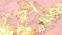
Map application displays objects belonging to the geohazard category. There are abandoned mine lands, underground mines, mining waste repository, ground instabilities objects and radon map. A short description is supplemented by links to more information. The layer of underground mines contains links to documentary photos.
application
https://registry.geology.cz/id/NGMD-GEOHAZARDY-SDE-APL_MOBIL
Map
GEMET - INSPIRE themes, version 1.0:


 ISO 19119:
GEMET - Concepts, version 3.1:
CGS Geoscientific themes:
ISO 19119:
GEMET - Concepts, version 3.1:
CGS Geoscientific themes:
chemical element/element of group 0/radon
11.99,
48.253,
18.91,
51.247
creation: 2018-09, publication: 2018-11-06
2018
-
now
RNDr. Vít Štrupl, Ph.D.
Kostelní 364/26,
Praha 7,
170 00,
Česká republika
tel: +420234742144
email:
vit.strupl@geology.cz
Role: point of contact
Ing. Martin Paleček
Leitnerova 204/22,
Brno,
602 00,
Česká republika
tel: +420543429261
email:
martin.palecek@geology.cz
Role: processor
Ing. Radek Svítil
Klárov 131/3,
Praha 1,
118 00,
Česká republika
tel: +420 257 089 448
email:
radek.svitil@geology.cz
Role: processor
Klárov 131/3,
Praha 1,
118 00,
Česká republika
tel: +420257089411
email:
metadata@geology.cz
Role: custodian
Data Quality
The application is based on CGS own technology to display map services using ESRI API 3.x. Its functionality and design are optimized for touch devices and small displays. Geolocation support makes the application suitable for field use. Base maps - detailed topographic maps and aerial photos - are provided by ČÚZK.
Constraints
Metadata about metadata
5bd9c014-ba44-4086-aca7-04770a010852
Mgr. Olga Moravcová, Ph.D.
Klárov 131/3,
Praha 1,
118 00,
Česká republika
tel: +420257089445
email:
olga.moravcova@geology.cz
Role: point of contact
2026-05-20