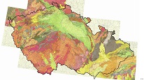
Geological map of Czechoslovakia 1 : 200,000 – territory of the CR (raster)


WMS service for accessing the geological maps at a scale of 1 : 200,000 from the area of the Czech Republic.
service
https://registry.geology.cz/id/NGMD_ARCH-GEOCR200_G_R-SDE-WMS
WMS
GEMET - INSPIRE themes, version 1.0:
 CGS Geoscientific themes:
European Geoscience Registry - Projects:
ISO 19119:
CGS Geoscientific themes:
European Geoscience Registry - Projects:
ISO 19119:
11.99,
48.253,
18.91,
51.247
publication: 2014-10-31
Klárov 131/3,
Praha 1,
118 00,
Česká republika
tel: +420257089411
email:
metadata@geology.cz
Role: custodian
Ing. Martin Paleček
Leitnerova 204/22,
Brno,
602 00,
Česká republika
tel: +420543429261
email:
martin.palecek@geology.cz
Role: point of contact
Data Quality
Constraints
Metadata about metadata
681228ea-a178-45b8-bec1-52850a010852
Mgr. Olga Moravcová, Ph.D.
Klárov 131/3,
Praha 1,
118 00,
Česká republika
tel: +420257089445
email:
olga.moravcova@geology.cz
Role: point of contact
2026-05-20