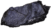
Photogrammetric 3D model of a niche on the 20th floor of the Rožná uranium mine (- 1000 m below ground)


Web visualization of the 3D photogrammetric model of a niche on the 20th floor of the Rožná uranium mine (- 1000 m below ground).
application
https://registry.geology.cz/id/3D-ROZINKA-FTGM-VIEWER
3DViewer
GEMET - Concepts, version 3.1:
CGS Geoscientific themes:
ISO 19119:
Spatial scope:
Free:
3D model
UAV
DOM
Rožná mine
16.2205,49.482,16.221,49.4825
creation: 2020-05-01, publication: 2020-08-01
2020
-
now
Ing. Radek Svítil
Klárov 131/3,
Praha 1,
118 00,
Česká republika
tel: +420 257 089 448
email:
radek.svitil@geology.cz
Role: point of contact
Klárov 131/3,
Praha 1,
118 00,
Česká republika
tel: +420257089411
email:
metadata@geology.cz
Role: custodian
Data Quality
Constraints
Metadata about metadata
5f734976-9a74-465c-ad13-1c440a010852
Mgr. Olga Moravcová, Ph.D.
Klárov 131/3,
Praha 1,
118 00,
Česká republika
tel: +420257089445
email:
olga.moravcova@geology.cz
Role: point of contact
2026-02-27