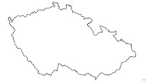
Hydrogeological map 1 : 50,000 – regions (documentation)
The ArcGIS Server map service displays hydrogeological documentation of maps that were processed during the solution of various types of projects in the CGS. Data on the chemical composition of groundwater and hydraulic properties of rocks are presented for selected archival wells. Descriptions, results of field measurements and photo documentation are available for individual hydrogeological objects documented in the field (eg springs).

service
https://registry.geology.cz/id/NGMD-HYDROCR50_REG_DOK-SDE-SER
ESRI_MAP
ISO 19119:
CGS Geoscientific themes:
GEMET - Concepts, version 3.1:
Spatial scope:
Free:
borehole
13.886,50.478,14.318,50.59
creation: 2020-05-31, publication: 2020-07-17
Ing. Martin Paleček
Leitnerova 204/22,
Brno,
602 00,
Česká republika
tel: +420543429261
email:
martin.palecek@geology.cz
Role: point of contact
Klárov 131/3,
Praha 1,
118 00,
Česká republika
tel: +420257089411
email:
metadata@geology.cz
Role: custodian
Data Quality
Jedná o převzaté objekty - vybrané vrty z Geofondu a dokumentační body z HG dokumentace pro zájmová území – regiony s hydrogeologickými mapami:
1. Litoměřicko – výstup projektu „Modernizace výzkumné infrastruktury RINGEN (RINGEN+)“ OP VVV
1. Litoměřicko – výstup projektu „Modernizace výzkumné infrastruktury RINGEN (RINGEN+)“ OP VVV
Constraints
Metadata about metadata
5ed63af3-9578-486b-9c1f-2f9f0a010852
Mgr. Olga Moravcová, Ph.D.
Klárov 131/3,
Praha 1,
118 00,
Česká republika
tel: +420257089445
email:
olga.moravcova@geology.cz
Role: point of contact
2025-04-24