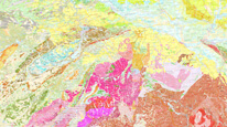
Geological map 1 : 50,000 (Lite)


Map application presents geological map of the Czech Republic at a scale of 1 : 50,000. There are also key information about boreholes objects registered in the descriptive database of Geologically documented objects.
application
https://registry.geology.cz/id/NGMD-GEOVEDNI-SDE-APL_MOBIL
Map
ISO 19119:
CGS Geoscientific themes:
11.99,
48.253,
18.91,
51.247
creation: 2018-09, publication: 2018-11-06
2018
-
now
Public access to maps.
Mgr. Lenka Kociánová, Ph.D.
Leitnerova 204/22,
Brno,
602 00,
Česká republika
tel: +420543429223
email:
lenka.kocianova@geology.cz
Role: point of contact
Ing. Martin Paleček
Leitnerova 204/22,
Brno,
602 00,
Česká republika
tel: +420543429261
email:
martin.palecek@geology.cz
Role: processor
Ing. Radek Svítil
Klárov 131/3,
Praha 1,
118 00,
Česká republika
tel: +420 257 089 448
email:
radek.svitil@geology.cz
Role: processor
Klárov 131/3,
Praha 1,
118 00,
Česká republika
tel: +420257089411
email:
metadata@geology.cz
Role: custodian
Data Quality
The application is based on CGS own technology to display map services using ESRI API 3.x. Its functionality and design are optimized for touch devices and small displays. Geolocation support makes the application suitable for field use. Base maps - detailed topographic maps and aerial photos - are provided by ČÚZK.
Constraints
Metadata about metadata
5bd9a5bc-0bb4-490d-8986-6a490a010852
Mgr. Olga Moravcová, Ph.D.
Klárov 131/3,
Praha 1,
118 00,
Česká republika
tel: +420257089445
email:
olga.moravcova@geology.cz
Role: point of contact
2026-02-27