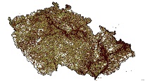
Borehole surveys with quaternary thickness
ArcGIS Server Service gives access to key information about drilling and objects registered in the descriptive database of geological objects.

service
https://registry.geology.cz/id/GDO-PRZ_KVARTER-SDE-SER
ESRI_MAP
ISO 19119:
CGS Geoscientific themes:
GEMET - Concepts, version 3.1:
GEMET - INSPIRE themes, version 1.0:
Free:
borehole
11.5826888350148,47.8179698239719,19.00421903453,51.357105092337
creation: 2017-12-15
1970-01-01
-
now
Ing. Martin Paleček
Leitnerova 204/22,
Brno,
602 00,
Česká republika
tel: +420543429261
email:
martin.palecek@geology.cz
Role: point of contact
Klárov 131/3,
Praha 1,
118 00,
Česká republika
tel: +420257089411
email:
metadata@geology.cz
Role: custodian
Data Quality
Constraints
Metadata about metadata
5b1666af-274c-4808-b424-1c300a010852
Mgr. Pavla Kramolišová
Kostelní 364/26,
Praha 7,
170 00,
Česká republika
tel: +420 234 742 161
email:
pavla.kramolisova@geology.cz
Role: point of contact
2025-04-24
