Hydrogeological zones (2005)


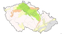
This ArcGIS Server service displays the hydrogeological zones of the Czech Republic territory as defined in 2005 at a scale of 1 : 50,000. It contains 3 layers: upper layer, basal cretaceous collector, base layer.
service
https://registry.geology.cz/id/NGMD-HGR_2005-SDE-SER
ESRI_MAP
ISO 19119:
CGS Geoscientific themes:
GEMET - Concepts, version 3.1:
Data theme, EU:
Free:
review of groundwater resources
review of resources
11.99,48.253,18.91,51.247
creation: 2012, revision: 2014
2005
Veřejný přístup k datům.
Ing. Martin Paleček
Leitnerova 204/22,
Brno,
602 00,
Česká republika
tel: +420543429261
email:
martin.palecek@geology.cz
Role: point of contact
Klárov 131/3,
Praha 1,
118 00,
Česká republika
tel: +420257089411
email:
metadata@geology.cz
Role: custodian
Data Quality
Constraints
Metadata about metadata
588f3dcd-d040-4496-9b9d-77d50a010852
Mgr. Pavla Kramolišová
Kostelní 364/26,
Praha 7,
170 00,
Česká republika
tel: +420 234 742 161
email:
pavla.kramolisova@geology.cz
Role: point of contact
2026-02-27