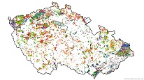
Territory data
WMS service makes accessible collective information on territory for information providing purpose by course of article 64 Act no. 283/2021 Coll. (Building act) from the following GIS layers: mining leases, protected areas of mineral deposits, areas protected against specific impacts in the Earth’s crust, reserved deposits and approved prognostic resources, registered mine workings (old mine workings), undermined areas, landslide areas, and non-reserved mineral deposits.

service
https://registry.geology.cz/id/UAP-ORP-SDE-WMS
WMS
1.3.0
European Geoscience Registry - Projects:
GEMET - Concepts, version 3.1:
Spatial scope:
GEMET - INSPIRE themes, version 1.0:
One Geology Europe - Concepts, version 1.0:
CGS Geoscientific themes:
ISO 19119:
11.685665,48.187355,19.050981,51.496057
revision: 2015-11-11
Provision of data on the territory pursuant to Section 64 of Act No. 283/2021 Coll. (Construction Act).
Czech Geological Survey
Ing. Martin Paleček
Leitnerova 204/22,
Brno,
602 00,
Česká republika
tel: +420543429261
email:
martin.palecek@geology.cz
Role: point of contact
Czech Geological Survey
Klárov 131/3,
Praha 1,
118 00,
Česká republika
tel: +420257089411
email:
metadata@geology.cz
Role: custodian
Data Quality
Constraints
Metadata about metadata
564f1b6b-6a18-47a5-9d60-27380a010852
Czech Geological Survey
Mgr. Pavla Kramolišová
Kostelní 364/26,
Praha 7,
170 00,
Česká republika
tel: +420 234 742 161
email:
pavla.kramolisova@geology.cz
Role: point of contact
2025-03-14

