Interesting geosites
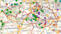
Map application is usable directly in the field thanks to its geolocation using GPS. It briefly and clearly describes geologically interesting sites in the Czech Republic – natural geological outcrops, caves and karst phenomenon or remains of human activities, mainly of mining origin. Description of the geosite includes a photo, note of its protection and other references. Moreover one can choose layer Building and decorative stones with basic information about displayed objects. Topographic and orthophoto maps of the State Administration of Land Surveying and Cadastre serve as background maps.

application
https://registry.geology.cz/id/NGMD-ZAJIMAVOSTI-SDE-APL
Map
GEMET - INSPIRE themes, version 1.0:
GEMET - Concepts, version 3.1:
ISO 19119:
CGS Geoscientific themes:
Free:
geological map
geological site
geopark
geological exposition
building and decorative stones
11.99,48.253,18.91,51.247
creation: 2015-06-30, revision: 2019-04-30
Aplikace vznikla v rámci projektu CZ.1.07/2.3.00/45.0038 "Vědou ke vzdělání, vzděláním k vědě".
RNDr. Markéta Vajskebrová, Ph.D.
Klárov 131/3,
Praha 1,
118 00,
Česká republika
tel: +420257089444
email:
marketa.vajskebrova@geology.cz
Role: point of contact
Ing. Radek Svítil
Klárov 131/3,
Praha 1,
118 00,
Česká republika
tel: +420 257 089 448
email:
radek.svitil@geology.cz
Role: processor
Klárov 131/3,
Praha 1,
118 00,
Česká republika
tel: +420257089411
email:
metadata@geology.cz
Role: custodian
Data Quality
The application is based on CGS own technology to display map services using ESRI API 3.x. Its functionality and design are optimized for touch devices and small displays.
Constraints
Metadata about metadata
55bb2623-9abc-4bec-b65e-62f60a010852
Mgr. Olga Moravcová, Ph.D.
Klárov 131/3,
Praha 1,
118 00,
Česká republika
tel: +420257089445
email:
olga.moravcova@geology.cz
Role: point of contact
2025-04-24
