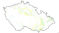
Quaternary map 1 : 500,000 (GEOCR500)
Quaternary map at a scale of 1:500 000 without bedrock geology was created for the project "Atlas krajiny" (Atlas of the landscape). The map shows the distribution of Quaternary aeolian, fluvial, glacial and organic sediments and volcanites, whereas the colluvial sediments are omitted. Fluvial gravel forms typical staircases. Recent floodplains are separately represented because of possible flooding during the high water stands. The glacial sediments appear marginally in northern Czechia and northern Moravia. The peats occur in the mountains, whereas fens are related to lower altitudes. Two types of travertines represent Quaternary carbonates. The first one are carbonates of thermal mineral water, the second precipitated from cold ground water.

service
https://registry.geology.cz/id/NGMD-GEOCR500_KVA-SDE-WMS
WMS
ISO 19119:
CGS Geoscientific themes:
GEMET - Concepts, version 3.1:
GEMET - INSPIRE themes, version 1.0:
Spatial scope:
11.9391596825,48.2338253671,18.9576171015,51.3548947086
creation: 2012-02-01
Ing. Martin Paleček
Leitnerova 204/22,
Brno,
602 00,
Česká republika
tel: +420543429261
email:
martin.palecek@geology.cz
Role: point of contact
Klárov 131/3,
Praha 1,
118 00,
Česká republika
tel: +420257089411
email:
metadata@geology.cz
Role: custodian
Data Quality
Constraints
Metadata about metadata
516e61b1-0f20-4550-847c-1e400a010817
Mgr. Pavla Kramolišová
Kostelní 364/26,
Praha 7,
170 00,
Česká republika
tel: +420 234 742 161
email:
pavla.kramolisova@geology.cz
Role: point of contact
2025-04-24
