Overview of produced 3D geological models


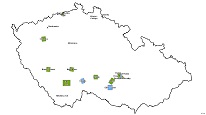
The ArcGIS Server service displays a map overview of 3D models that were created by the Czech Geological Survey for different areas of interest within the territory of the Czech Republic.
service
https://registry.geology.cz/id/3D-PREHLED_MODELU-GDB-SER
ESRI_MAP
ISO 19119:
CGS Geoscientific themes:
GEMET - Concepts, version 3.1:
Spatial scope:
Free:
3D models
12.09,
48.55,
18.86,
51.06
creation: 2019-02-28
Map overview for the web page about the 3D geological modelling at CGS.
Ing. Martin Paleček
Leitnerova 204/22,
Brno,
602 00,
Česká republika
tel: +420543429261
email:
martin.palecek@geology.cz
Role: point of contact
Klárov 131/3,
Praha 1,
118 00,
Česká republika
tel: +420257089411
email:
metadata@geology.cz
Role: custodian
Data Quality
Constraints
Metadata about metadata
623acffa-2c54-497f-b303-7e5c0a010852
Ing. Lucie Kondrová, Ph.D.
Klárov 131/3,
Praha 1,
118 00,
Česká republika
tel: +420257089434
email:
lucie.kondrova@geology.cz
Role: point of contact
2026-02-27