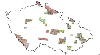
Geological map of geological units including the Quaternary cover 1 : 25,000 (GEOCR25)


WMS service displays Geological map of geological units including the Quaternary cover at a scale of 1: 25,000.
service
https://registry.geology.cz/id/NGMD-GEOCR25_G_ZAKRYTA-SDE-WMS
WMS
1.3.0

12.627,
48.377,
18.488,
51.329
publication: 2019-01-01
Results of Geological mapping in a scale of 1 : 25,000 (GEOCR25) in map sheets ZM25, since 1999.
Klárov 131/3,
Praha 1,
118 00,
Česká republika
tel: +420257089411
email:
metadata@geology.cz
Role: custodian
Ing. Martin Paleček
Leitnerova 204/22,
Brno,
602 00,
Česká republika
tel: +420543429261
email:
martin.palecek@geology.cz
Role: point of contact
Data Quality
Constraints
Metadata about metadata
61f91bab-15fc-40a9-972d-74700a010852
Mgr. Pavla Kramolišová
Kostelní 364/26,
Praha 7,
170 00,
Česká republika
tel: +420 234 742 161
email:
pavla.kramolisova@geology.cz
Role: point of contact
2026-05-20