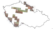
Soil map 1 : 50,000 – older mapping (raster)


ArcGIS Server service provides access to scans of soil maps from older CGS mappings at a scale of 1: 50,000 on map sheets, where there are still no vector soil maps of the 2012 edition.
service
https://registry.geology.cz/id/NGMD_ARCH-GEOCR50_PED_R-SDE-SER
ESRI_MAP
CGS Geoscientific themes:
GEMET - INSPIRE themes, version 1.0:
 ISO 19119:
Spatial scope:
ISO 19119:
ISO 19119:
Spatial scope:
ISO 19119:
Free:
soil typology
12.008832,48.239152,18.957832,51.355194
creation: 2019-05-21
Ing. Martin Paleček
Leitnerova 204/22,
Brno,
602 00,
Česká republika
tel: +420543429261
email:
martin.palecek@geology.cz
Role: point of contact
Klárov 131/3,
Praha 1,
118 00,
Česká republika
tel: +420257089411
email:
metadata@geology.cz
Role: custodian
Data Quality
Constraints
Metadata about metadata
5ced40e9-3890-4283-8dba-57730a010852
Mgr. Olga Moravcová, Ph.D.
Klárov 131/3,
Praha 1,
118 00,
Česká republika
tel: +420257089445
email:
olga.moravcova@geology.cz
Role: point of contact
2026-02-27