Geophysical surveys


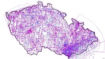
ArcGIS Server service contains information on geophysical measurements made mainly by Geofyzika Brno since the early 1950s. Areas covered by regional surveys are depicted on 1:200 000 scale maps and local small-scale measurements at scale of 1:50 000.
service
https://registry.geology.cz/id/GFY-GFP-SDE-SER
ESRI_MAP
1.3.0
ISO 19119:
CGS Geoscientific themes:
GEMET - INSPIRE themes, version 1.0:
 Spatial scope:
Free:
geophysical surveys
CzechGeo
EGDI
11.7837223412297,47.8441726730581,20.0852358570367,51.4922746621735
creation: 2013-01-16, revision: 2018-01-01
Ing. Martin Paleček
Leitnerova 204/22,
Brno,
602 00,
Česká republika
tel: +420543429261
email:
martin.palecek@geology.cz
Role: point of contact
Klárov 131/3,
Praha 1,
118 00,
Česká republika
tel: +420257089411
email:
metadata@geology.cz
Role: custodian
Data Quality
Constraints
Metadata about metadata
5ad0bad7-44a4-4f8a-9d4c-313a0a010852
Mgr. Pavla Kramolišová
Kostelní 364/26,
Praha 7,
170 00,
Česká republika
tel: +420 234 742 161
email:
pavla.kramolisova@geology.cz
Role: point of contact
2026-03-06