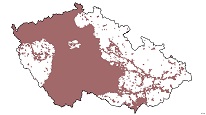
CGS assessments of land development and land-use plans
ArcGIS Server Service provides access to documents of CGS assessments of land development and land-use plans for state and public administration of the Czech Republic.

service
https://registry.geology.cz/id/EXP-VYJADRENI_UP-SDE-SER
ESRI_MAP
ISO 19119:
GEMET - Concepts, version 3.1:
CGS Geoscientific themes:
11.99,48.253,18.91,51.247
creation: 2016
1992
-
Veřejný přístup k datům.
Ing. Martin Paleček
Leitnerova 204/22,
Brno,
602 00,
Česká republika
tel: +420543429261
email:
martin.palecek@geology.cz
Role: point of contact
Klárov 131/3,
Praha 1,
118 00,
Česká republika
tel: +420257089411
email:
metadata@geology.cz
Role: custodian
Ing. Martin Paleček
Leitnerova 204/22,
Brno,
602 00,
Česká republika
tel: +420543429261
email:
martin.palecek@geology.cz
Role: processor
Data Quality
Constraints
Distribution
Metadata about metadata
57cff0f9-db08-42c2-b419-2d7d0a010852
Mgr. Olga Moravcová, Ph.D.
Klárov 131/3,
Praha 1,
118 00,
Česká republika
tel: +420257089445
email:
olga.moravcova@geology.cz
Role: point of contact
2025-04-24