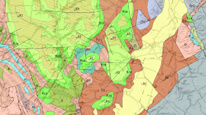
Geological map 1 : 500,000


Map server application presents the results of the geological maps of the Czech Republic at a scale of 1 : 500,000 (GEOCR500). Maps describe bedrock geology and also (in Czech version of the application) additional derived maps: radon risk, engineering–geological zones and quaternary geology.
application
https://registry.geology.cz/id/NGMD-GEOCR500-SDE-APL
Map
ISO 19119:
GEMET - INSPIRE themes, version 1.0:

 Spatial scope:
CGS Geoscientific themes:
GEMET - Concepts, version 3.1:
Spatial scope:
CGS Geoscientific themes:
GEMET - Concepts, version 3.1:
11.99,
48.253,
18.91,
51.247
creation: 2013, publication: 2013, revision: 2018-12-19
2003
-
now
Public access to maps.
Mgr. Lenka Kociánová, Ph.D.
Leitnerova 204/22,
Brno,
602 00,
Česká republika
tel: +420543429223
email:
lenka.kocianova@geology.cz
Role: point of contact
Ing. Martin Paleček
Leitnerova 204/22,
Brno,
602 00,
Česká republika
tel: +420543429261
email:
martin.palecek@geology.cz
Role: processor
Klárov 131/3,
Praha 1,
118 00,
Česká republika
tel: +420257089411
email:
metadata@geology.cz
Role: custodian
Data Quality
3.10.2017:
The Czech version of the map application was remade into Web AppBuilder and published in https mode.
A layer of Mineral Water of the Czech Republic was added.
English version of the application was terminated on 12/2018.
revision: 2014, revision: 03 .10. 2017, revision: 19 .12. 2018
The Czech version of the map application was remade into Web AppBuilder and published in https mode.
A layer of Mineral Water of the Czech Republic was added.
English version of the application was terminated on 12/2018.
revision: 2014, revision: 03 .10. 2017, revision: 19 .12. 2018
Constraints
Metadata about metadata
528ca902-64b8-431f-94ac-04a00a010817
Mgr. Olga Moravcová, Ph.D.
Klárov 131/3,
Praha 1,
118 00,
Česká republika
tel: +420257089445
email:
olga.moravcova@geology.cz
Role: point of contact
2026-02-27