Mining impacts


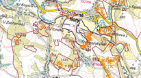
This map application Mining impacts (Abandoned Mine Lands, Underground Mines) displays basic information about mine workings, undermined areas and sites used for the disposal of mining waste in the same map window.
application
https://registry.geology.cz/id/VDC-DD_PODDOL-SDE-APL
Map
ISO 19119:
Spatial scope:
GEMET - INSPIRE themes, version 1.0:

 CGS Geoscientific themes:
11.99,
48.253,
18.91,
51.247
creation: 2011-12-31, revision: 2017-10-03
Vyhledávání základních informací o poddolovaných územích, hlavních důlních dílech a haldách s možností zadávání parametrů pro vyhledávání.
Mgr. Jolana Skřivánková
Dačického náměstí 11/7,
Kutná Hora,
284 01,
Česká republika
tel: +420327515724
email:
jolana.skrivankova@geology.cz
Role: point of contact
Ing. Martin Paleček
Leitnerova 204/22,
Brno,
602 00,
Česká republika
tel: +420543429261
email:
martin.palecek@geology.cz
Role: processor
Klárov 131/3,
Praha 1,
118 00,
Česká republika
tel: +420257089411
email:
metadata@geology.cz
Role: custodian
Data Quality
The Czech version of the map application was remade into Web AppBuilder and published in https mode on 3.10.2017.
English version (Gis Viewer) out of operation since 12/2018.
revision: 2014, revision: 2017-10-03
English version (Gis Viewer) out of operation since 12/2018.
revision: 2014, revision: 2017-10-03
Constraints
Metadata about metadata
4f779d3c-1910-44b0-b5a1-1da00a010817
Mgr. Pavla Kramolišová
Kostelní 364/26,
Praha 7,
170 00,
Česká republika
tel: +420 234 742 161
email:
pavla.kramolisova@geology.cz
Role: point of contact
2026-02-27